Mehrad Moradipour
M.Sc. Spatial Planning student at TU Dortmund and Research Assistant on the EU-funded AquaINFRA project at Hochschule Bochum — turning spatial data into planning decisions with GIS, Python, and R.
About Me

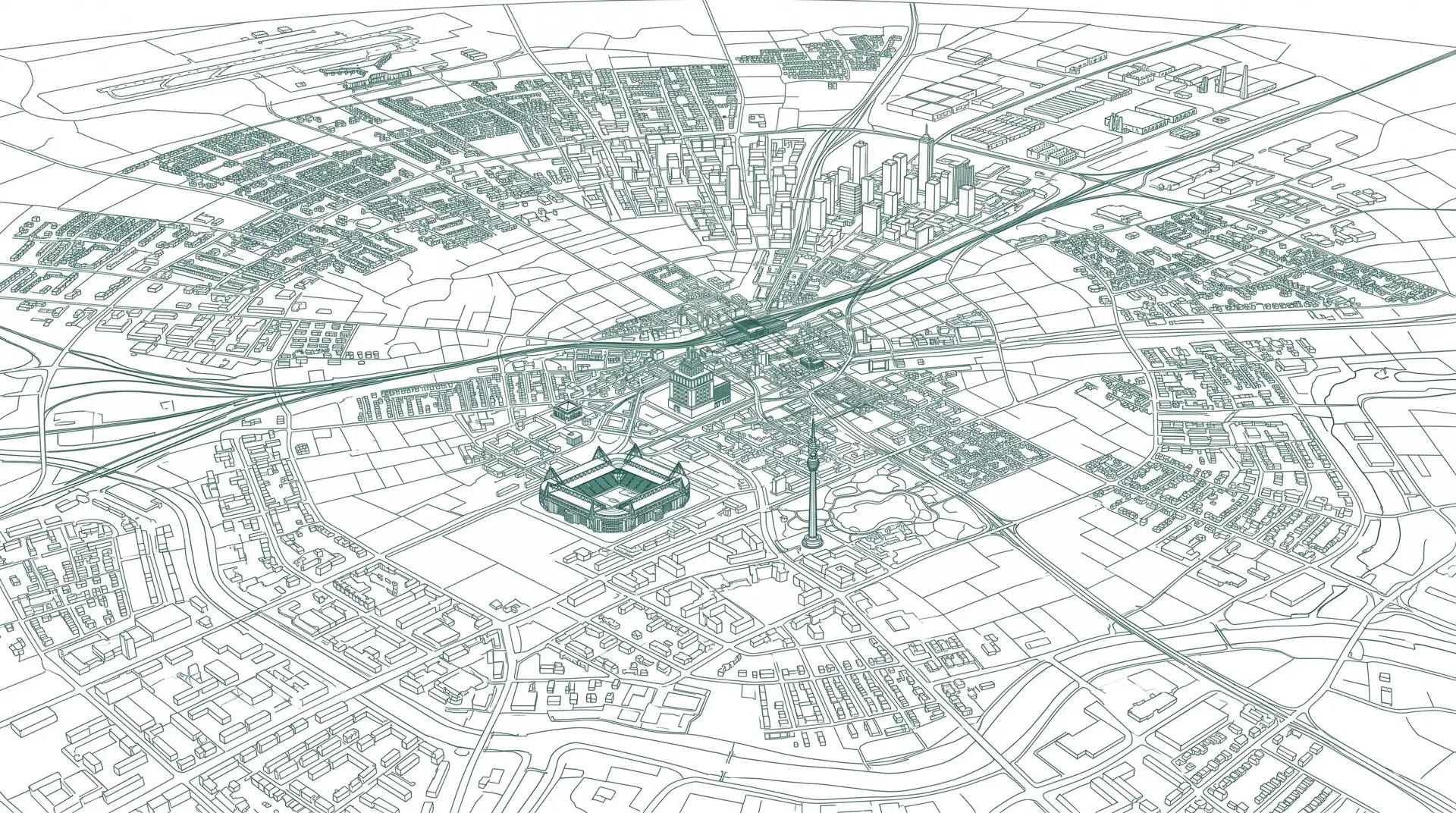
GIS and spatial data analyst with over three years of professional experience in geospatial analysis and urban planning, currently working on the EU-funded AquaINFRA research project at Hochschule Bochum. I combine ArcGIS and QGIS with Python, R, SQL, and Docker to build reproducible, FAIR-compliant spatial data workflows.
Spatial Analysis
Demographic accessibility models, spatial autocorrelation, and geospatial mapping.
FAIR & Open Data
Reproducible research workflows, open educational resources, and FAIR-compliant geospatial data publishing.
Geoprocessing Pipelines
Docker, R spatial-analysis packages, and Python scripting for data cleaning and statistics.
Education & Experience
Research Assistant
- Contributed to the EU-funded AquaINFRA project team to develop open educational resources for the AquaINFRA Training Handbook, including tutorial video production.
- Contributed to the AquaINFRA Elbe use case, working on a Docker-based R analysis pipeline for the dasymetric refinement of population data.
- Co-developed FAIR-compliant educational modules for NFDI4Earth in the EduTrain portal courses.
- Supported the organisation of technical workshops.
Urban Planner
- Supported the revitalisation of local development plans with geospatial analyses in ArcGIS and QGIS, identifying spatial trends for the planning team.
- Contributed multi-layer GIS visualisations and thematic maps to multidimensional analyses for planning decisions.
M.Sc. in Spatial Planning
Focus on spatial data analysis, urban and regional planning, and sustainable development.
Project: Quality of Accessibility to Stationary Grocery Retailers in Dortmund (2022).
Certificate: Summer School for Sustainability (August 2024).
B.Sc. in Urban Engineering
Courses in urban engineering, urban infrastructure design, and transportation planning.
Languages
Skills & Software
Geoinformation & Data Analysis
CAD & BIM Software
Programming & Data Analysis
Developer Tools
AI-Assisted Development
Design & Creative Software
Office & Productivity
Projects
AquaINFRA Population Data Refinement
Developed a reproducible spatial-analysis pipeline for dasymetric refinement of human population data to support environmental and marine planning use cases in the Elbe River Basin.
My Responsibilities:
- Designed and implemented a Docker-based R analysis pipeline for spatial data processing.
- Constructed reproducible dasymetric refinement algorithms to map population distributions.
- Contributed open educational resources (OER) to the AquaINFRA Training Handbook.
Walking Accessibility to Grocery Retailers
Evaluated physical accessibility to stationary grocery stores for technologically disadvantaged demographic groups in Dortmund, assessing risks of social exclusion in the e-grocery era.
My Responsibilities:
- Analyzed demographics of older, lower-income, and immigrant groups via spatial statistics.
- Conducted Local Moran's I spatial autocorrelation and scatterplot analyses to map spatial clusters of disadvantage.
- Visualized hot zones and calculated network accessibility using GIS.
Publications
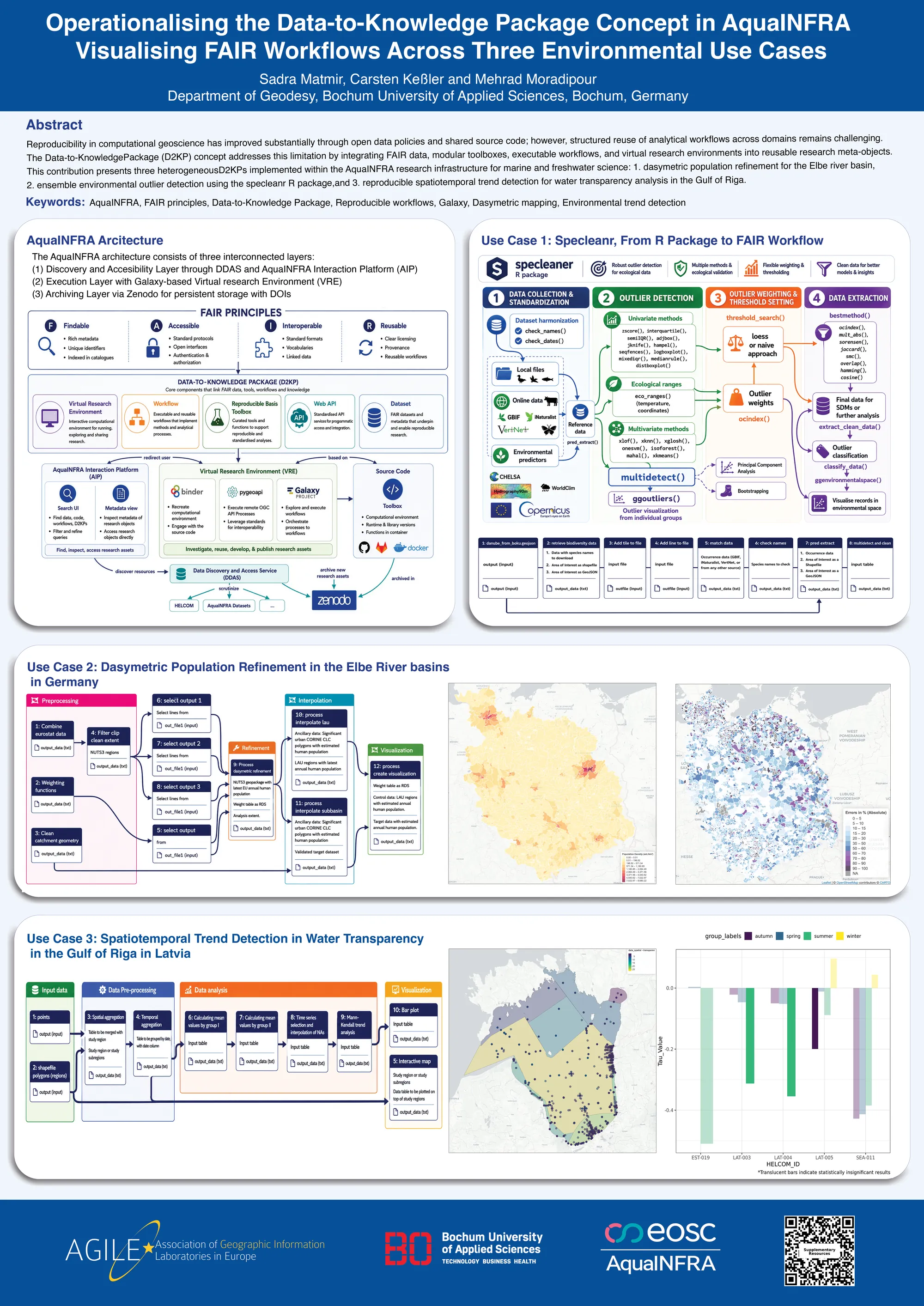
Operationalising the Data-to-Knowledge Package Concept: Visualising FAIR Workflows Across Three Environmental Use Cases
This contribution presents three heterogeneous Data-to-Knowledge Packages (D2KPs) implemented within the AquaINFRA research infrastructure for marine and freshwater science. It showcases how reproducible research can be operationalized and transformed into interoperable, reusable geospatial services.
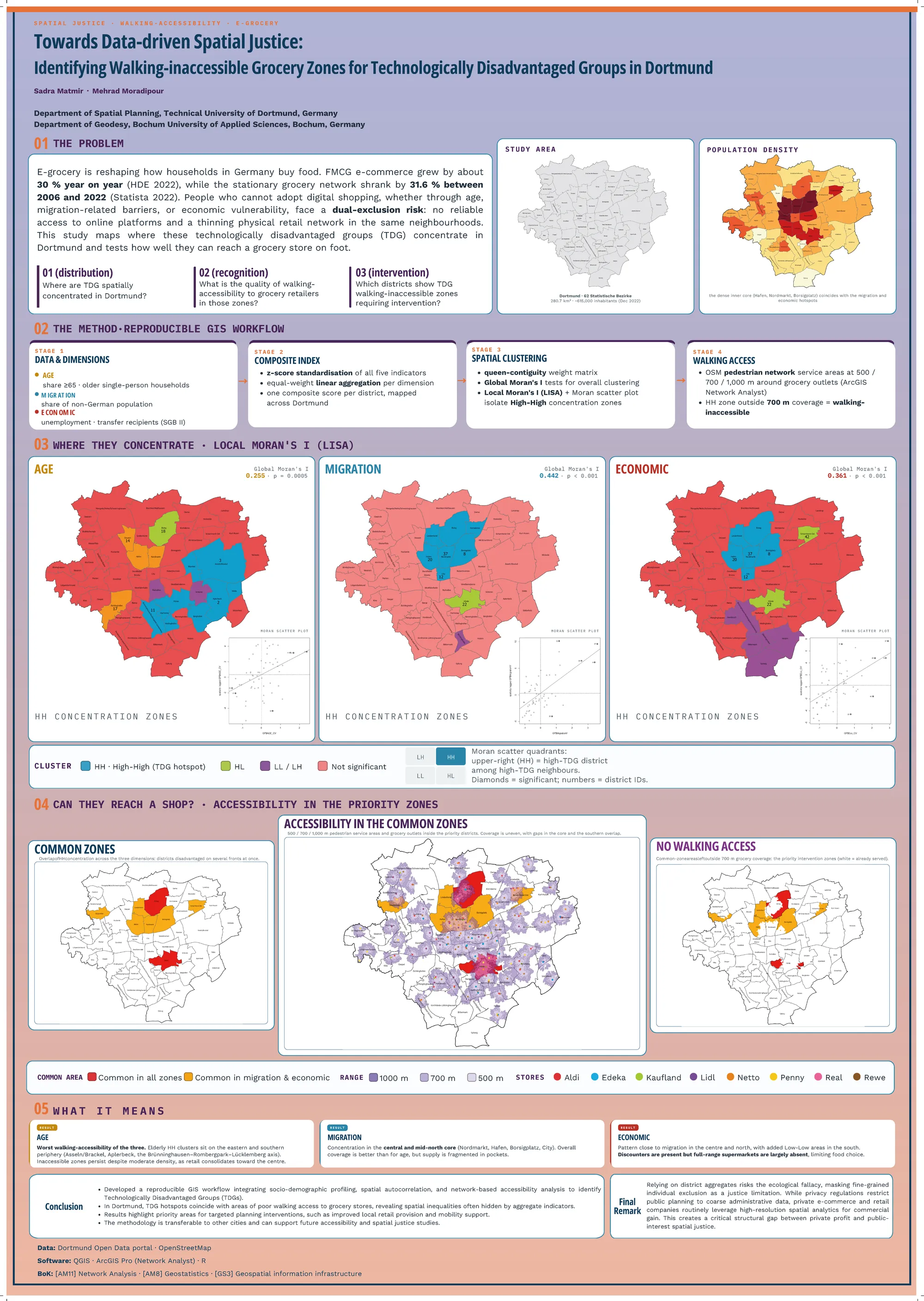
Towards Data-driven Spatial Justice: Identifying Walking-inaccessible Grocery Zones for Technologically Disadvantaged Groups in Dortmund
Analyzes walking accessibility to stationary grocery retailers for technologically disadvantaged groups (TDGs) facing digital and physical exclusion in Dortmund, Germany. The study uses network-based service-area and spatial autocorrelation analyses (Local Moran's I) to identify priority zones for urban-planning interventions.
Interested in collaborating?
I am always open to discussing spatial-planning opportunities, geospatial data pipelines, and research projects. Send me a message directly, or connect via the channels below.
or reach me on